Set It and Forget It: Why Charlotte Builders Are Moving to Recurring Drone Documentation

A construction site changes every week.
The pad is cut. The foundation follows. Framing rises. Utilities move. Access shifts. Materials arrive and leave.
A one-off flyover captures a moment. A recurring flight captures the project.
For builders and developers across the Charlotte metro area, weekly or biweekly drone documentation is becoming a practical way to keep owners, crews, lenders, and stakeholders aligned without adding another meeting to the calendar.
The principle is simple:
Set the cadence. Repeat the flight plan. Build the record.
01 → Consistency turns images into information
Random aerial photos are useful for presentation. They are less useful for comparison.
Recurring construction drone photography follows the same flight path, altitude, and primary viewpoints each time. That consistency creates a visual timeline that can be reviewed from one visit to the next.
The difference is immediate.
Instead of asking:
> “What changed since the last update?”
Your team can see it.
The same views reveal:
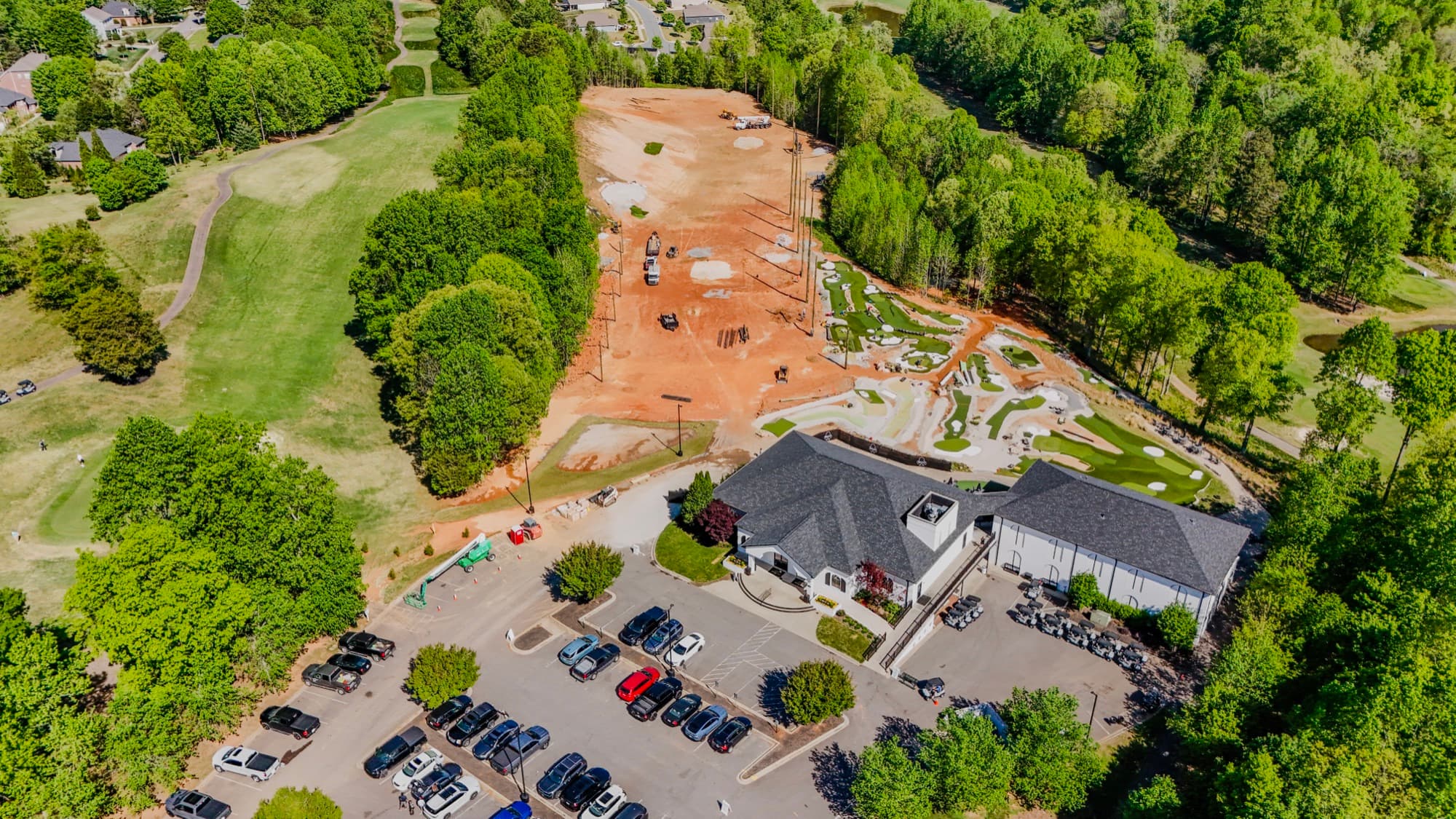
Site clearing and grading progress.
Foundation and slab work.
Framing and structural milestones.
Building envelope completion.
Material staging and equipment movement.
Access routes and circulation changes.
Landscaping, paving, and final site work.
The images become a repeatable reference. Each flight adds another frame to the project’s visual sequence.
SQO SkyWorks plans recurring flights around the parts of the site your team actually needs to see: access, staging, grades, setbacks, building progress, and surrounding context. Learn more about construction and development progress documentation.
02 → Early visibility supports earlier decisions
Small site issues can become expensive when they remain invisible.
A blocked access route can disrupt deliveries. Poor staging can slow several trades at once. Unexpected grading conditions can affect drainage, utilities, or future site work. A schedule can drift quietly before the delay appears in a formal report.
Recurring aerial documentation gives project leaders another view of the work.
Side-by-side construction progress photos can help teams identify:
Work that appears out of sequence.
Areas where site movement has slowed.
Stockpiles or equipment affecting access.
Changes in grades or drainage patterns.
Incomplete work at a scheduled milestone.
Conflicts between active work zones.
Conditions that require a closer ground-level review.
Drone imagery does not replace field supervision, engineering judgment, or formal inspections. It adds a broad, current layer of visibility.
That layer matters when decision-makers cannot be on-site every day.
Owners can review progress remotely. Developers can compare multiple active projects. Project managers can use the latest aerials during coordination meetings. Stakeholders can work from the same visual reference instead of separate phone photos and partial updates.
The earlier the condition is visible, the more options the team has.
03 → A dated record protects the project
Construction records should answer basic questions clearly:
What was on-site? When was it there? Where was the work? What had changed?
A recurring documentation program creates a dated archive from pre-construction through completion. Each flight provides a time-specific record of the site’s condition and progress.
That record can support:
Owner updates.
Lender and draw-request packages.
Schedule discussions.
Change-order conversations.
Coordination between builders and design teams.
Closeout reference.
Internal project reviews.
Future property management needs.
It also gives teams a stronger factual foundation when questions arise about timing or site conditions.
This is not about creating alarm. It is about keeping the project history legible.
A complete archive can show when a building phase began, when access changed, when materials arrived, or when a particular area reached completion. It gives owners and contractors a common point of reference.
For liability and risk management, the value is in the consistency. A single image may document a condition. A series of dated images shows how that condition developed.
Every SQO SkyWorks construction flight is completed under FAA Part 107 operations and full insurance. The FAA’s Remote Pilot Certificate requirements provide the regulatory foundation for commercial drone operations.
04 → Mapping keeps the whole site in view
A camera pointed at one building cannot always explain the site around it.
Construction and development teams often need broader context:
How does the building relate to the property boundary?
Is the access route changing?
Where are the drainage paths?
How is the graded pad positioned within the parcel?
What areas remain undeveloped?
How does the project connect to nearby roads and properties?
This is where recurring drone mapping services can add structure to the documentation program.
A planned grid flight can produce a high-resolution orthomosaic: a corrected, top-down map that gives teams a complete view of the site. Repeatable mapping flights can then show how the parcel changes through clearing, grading, infrastructure work, and construction.
The result is not just a collection of attractive images. It is a visual reference that helps people understand the project’s shape, scale, and movement.
SQO SkyWorks delivers aerial mapping with organized files, edited stills, and supporting views based on how the information will be used. The goal is straightforward:
Capture the full site. Clarify the next decision.

05 → One program creates a complete marketing story
The marketing value is a useful bonus.
Most projects are marketed at the beginning and at the end. The middle is often missing.
Recurring flights change that.
A construction timeline can show the full story:
→ Raw land
→ Clearing and grading
→ Foundation work
→ Framing
→ Exterior completion
→ Site improvements
→ Finished property
That sequence can support:
Website project pages.
Social media updates.
Investor and owner presentations.
Proposal decks.
Community outreach.
Leasing materials.
Recruiting content.
Completion announcements.
Portfolio case studies.
A finished aerial video shows the result. A complete build-cycle visual story shows the work behind it.
For developers and builders, that story can demonstrate scale, coordination, craftsmanship, and progress. It can also become a reusable library of visual assets rather than a single closing-day photo.
SQO SkyWorks provides marketing and visual media with edited aerial photos and video ready for web, listings, presentations, and social channels.
06 → The recurring workflow is simple
A recurring program does not need to create more work for your team.
01 : Set the cadence
Choose weekly, biweekly, monthly, or milestone-based flights.
Weekly flights are useful during fast-moving phases such as grading, foundations, and structural work. Biweekly flights can provide a steady record when the site is moving at a slower pace.
02 : Define the viewpoints
Identify the areas that matter most.
The building footprint. The access road. The staging zone. The surrounding parcel. The landscape edge. The work your team reviews repeatedly.
03 : Repeat the flight
SQO SkyWorks uses consistent angles and altitudes so each visit compares cleanly with the last.
The flight plan becomes the project’s visual grid.
04 : Receive finished files
Still images are color-corrected. Video is edited. Files are organized for reports, updates, and presentations.
Fast turnaround keeps the record current instead of leaving the latest flight in an editing queue.
05 : Build the archive
Each visit stacks onto the previous one.
Over time, the archive becomes a practical project history and a ready-made marketing library.

Why Charlotte projects benefit from a repeatable view
The Charlotte metro area continues to combine infill construction, suburban growth, commercial development, residential projects, and large undeveloped parcels.
That variety creates different documentation needs. A tight urban site may require attention to access and surrounding structures. A larger suburban tract may require broader mapping and grade context. A commercial project may need clear views of parking, circulation, and site integration.
The flight plan should reflect the project.
SQO SkyWorks is based in Charlotte and serves the Greater Charlotte Area. With a background in landscape design and site planning, Shane Blackwell frames each flight around practical project questions: not just the most dramatic angle.
The result is aerial photography Charlotte NC builders can use to understand, document, and communicate the work.
The practical conclusion
One-off aerial photography has a place.
It can capture a groundbreaking, a milestone, a finished building, or a strong marketing image.
But recurring documentation does more.
It creates consistency.
It improves visibility.
It supports earlier decisions.
It strengthens the project record.
It turns progress into a story.
Set the cadence once. Let the record build itself.
For recurring construction drone photography, site documentation, or drone mapping services in the Charlotte metro area, contact SQO SkyWorks for a project-specific quote.
You can also call (704) 783-6767 or review the full range of Charlotte drone services.
Ready to put your project in the air?
Get a free quote →